Uttarakhand Flash Floods
Causes, Impact, and Lessons for the Future
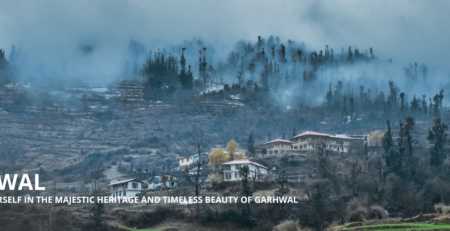
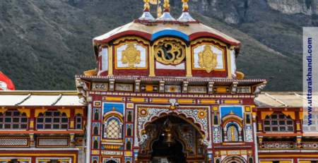
Uttarakhand, often called the Devbhoomi or “Land of the Gods,” is a Himalayan state known for its breathtaking peaks, sacred rivers, and world-famous pilgrimages like the Char Dham Yatra. But behind this natural beauty lies a recurring tragedy – flash floods and cloudbursts that devastate the region almost every monsoon.
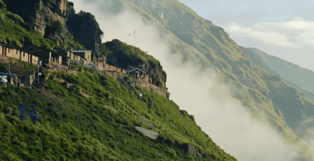
The people of Uttarakhand once knew a simple truth – rivers and gadheras are not to be challenged. Our ancestors never built their villages on floodplains, respecting the force of water. Today, that wisdom is forgotten. Multi-storey hotels and illegal constructions rise on riverbanks, weakening mountain bases and turning every cloudburst into a disaster. This sacred land was meant for pilgrimage and spiritual journeys – not honeymoon resorts or picnic spots. Greed and negligence are erasing the soul of the Himalayas. Unless the government takes strict action, Uttarakhand will continue to pay with lives, heritage, and faith itself.
In August 2025, a sudden flash flood in Dharali village, Uttarkashi, once again reminded the world of the fragile balance between nature and human survival in the Himalayas. Within minutes, streams swelled into raging torrents, sweeping away homes, markets, and lives.
These floods are not new to Uttarakhand. The state has witnessed catastrophic events in 2013 (Kedarnath tragedy), 2021 (Chamoli glacier disaster), and now 2025, each disaster underscoring the vulnerability of the mountains to extreme weather, melting glaciers, and unplanned development.
The introduction of climate change into this equation has made things worse: rainfall patterns are becoming more unpredictable, glaciers are retreating faster, and fragile slopes are collapsing more often. As a result, flash floods in Uttarakhand are no longer rare – they are becoming a seasonal crisis that threatens lives, livelihoods, and ecosystems.
History of Flash Floods & Related Disasters in Uttarakhand (2000–2025)
“Our ancestors never built homes on riversides – today’s greed has turned sacred streams into graveyards.”
Uttarakhand, nestled in the fragile Himalayas, has witnessed some of the deadliest natural disasters in India over the last two decades. Known as Devbhoomi for its sacred rivers and temples, the state has also become a hotspot for flash floods, cloudbursts, and glacial outburst floods (GLOFs). These disasters are triggered by extreme rainfall, unstable glaciers, and fragile mountain terrain, often magnified by unplanned human development. Between 2000 and 2025, Uttarakhand has experienced more than a dozen major flood-related tragedies. The 2001 Phata-Byung cloudburst, the 2012 Uttarkashi floods, and the 2013 Kedarnath disaster, which killed over 5,000 people, remain etched in memory as stark warnings of nature’s fury. The 2021 Chamoli glacier disaster again highlighted the dangers of glacial melt and hydropower projects in high-risk zones. Most recently, in August 2025, Dharali village in Uttarkashi was devastated when a sudden surge in the Kheer Ganga stream buried markets and homes under mud and boulders.
This 25-year history shows a worrying trend – disasters are becoming more frequent, more intense, and deadlier, fueled by climate change and reckless development. Understanding this history is key to preventing future tragedies in the Himalayan state.
2001 – Phata-Byung Gad Cloudburst (Rudraprayag District)
- Date: 16 July 2001
- Intense cloudburst triggered flash floods and landslides.
- Impact: 27 people killed, 22 houses destroyed, 64 livestock lost, 43 hectares of farmland damaged.
2002 – Khetgaon & Bhatwari-Dunda Flash Floods
- Date: July & August 2002
- Flash floods struck villages in Pithoragarh and Uttarkashi.
- Impact: Around 10 people died, dozens of livestock killed, homes damaged.
2012 – Bhagirathi Valley Flash Flood (Uttarkashi)
- Date: 3 August 2012
- Exceptionally heavy rainfall caused flash floods and landslides in the Bhagirathi–Asi Ganga catchment.
- Impact: 28 dead, 6 missing, hundreds of livestock lost, 55 hectares farmland destroyed, more than 1,100 families affected.
2013 – Kedarnath Disaster (Mandakini Basin)
- Date: 16–17 June 2013
- Triggered by cloudbursts, glacial outburst, and extreme rainfall.
- Impact: 5,000+ people killed or missing, 3,000+ houses and 147 bridges destroyed, 1,300 km of roads damaged, 300,000+ pilgrims stranded.
- One of India’s worst-ever natural disasters.
2021 – Chamoli Glacier Disaster (Rishiganga/Dhauliganga)
- Date: 7 February 2021
- A massive rock–ice avalanche triggered flash floods in the Rishiganga and Dhauliganga rivers.
- Impact: Over 200 people killed or missing, two hydropower projects destroyed, damages worth millions.
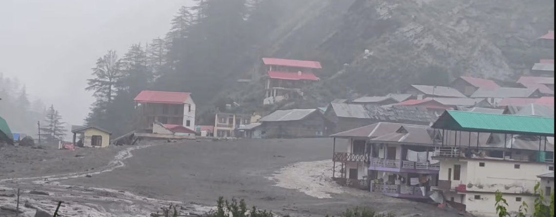
2025 – Dharali Flash Flood (Uttarkashi)
- Date: 5 August 2025
- A sudden surge in the Kheer Ganga stream caused flash flooding in Dharali village.
- Impact: At least 5 people dead, 50–100 missing, dozens of houses, hotels, and a highway stretch destroyed, hundreds evacuated.
| Year | Location / Event | Cause / Trigger | Death Toll (Approx.) | Key Impact |
|---|---|---|---|---|
| 2001 | Phata-Byung Gad, Rudraprayag | Cloudburst + flash flood | 27 | 22 houses destroyed, 64 livestock lost, farmland damaged |
| 2002 | Khetgaon (Pithoragarh) & Bhatwari-Dunda (Uttarkashi) | Flash floods after heavy rain | 10 | Families swept away, livestock & property loss |
| 2012 | Bhagirathi Valley, Uttarkashi | Extreme rainfall → flash flood & landslides | 28 dead, 6 missing | 1,100+ families affected, farmland & houses damaged |
| 2013 | Kedarnath Disaster (Mandakini basin) | Cloudburst + glacial lake outburst + monsoon | 5,000+ | Town destroyed, 3,000+ houses & 147 bridges lost, 300,000 stranded |
| 2021 | Chamoli Glacier Disaster (Rishiganga & Dhauliganga) | Glacier-rock-ice avalanche | 200+ | 2 hydropower projects destroyed, huge economic loss |
| 2025 | Dharali, Uttarkashi | Cloudburst / sudden surge in Kheer Ganga stream | 5 dead, 50–100 missing | Market & homes buried, highway washed away, hundreds evacuated |
Why Does Uttarakhand Face So Many Flash Floods?
When we build on riverbanks, we are not constructing — we are inviting destruction.
When people think of Uttarakhand, they imagine snow-capped Himalayan peaks, sacred rivers like the Ganga, and the spiritual Char Dham Yatra. But behind this beauty lies a darker reality – flash floods, landslides, and cloudbursts that strike the state almost every monsoon.
The reasons are not just natural but also deeply tied to climate change and human activity. Let’s break them down in detail.
1. Geography & Terrain
- Uttarakhand is a Himalayan mountain state with extremely steep slopes. Rainwater cannot seep into the ground here; it rushes downhill at high velocity.
- Small mountain streams, known locally as gadheras, swell into raging torrents within minutes during heavy rain.
- Major rivers like the Bhagirathi, Alaknanda, Mandakini, and Dhauliganga flow through narrow valleys. When water levels suddenly rise, these valleys act like funnels, amplifying the destructive force of floods.
- Example: In the 2013 Kedarnath disaster, a combination of rain and glacial melt triggered massive flooding. Entire valleys were buried under debris, killing thousands of pilgrims and locals.
2. Cloudbursts
- A cloudburst is an extreme weather event in which more than 100 mm of rainfall occurs within an hour or less.
- In Uttarakhand’s high-altitude terrain, the clash between warm and cold winds creates conditions for these sudden, localized storms.
- The rainfall falls directly into valleys and streams, producing instant floods that leave little time for evacuation.
- Examples: 2010 Pithoragarh cloudburst (200+ deaths), 2013 Kedarnath floods, and the 2025 Dharali tragedy.
- In August 2025, IMD recorded 369% above normal rainfall in just 24 hours, clear evidence of climate extremes.
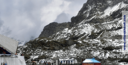
3. Glacial Lakes & Melting (GLOFs)
- Uttarakhand is home to more than 1,200 glaciers, many retreating rapidly due to global warming.
- Melting glaciers form unstable glacial lakes held by loose soil and rock moraines, prone to bursting.
- A burst triggers a Glacial Lake Outburst Flood (GLOF), releasing huge volumes of water downstream.
- Example: 2021 Chamoli disaster killed 200+, destroying hydropower projects. Dharali 2025 may also have links to glacial surge.
- Scientists warn expanding lakes near Gangotri, Pindari, and Milam are “ticking time bombs.”
4. Unplanned Development
Human activities amplify natural risks in Uttarakhand:
- Hydropower Projects: 70+ dams disturb rivers. In 2013 & 2021, projects were destroyed, worsening floods.
- Road Widening & Blasting: Char Dham All Weather Road weakens slopes; highways often blocked by landslides for weeks.
- Encroachments: Hotels & shops on riverbanks face first impact. In 2025 Dharali, the market was buried under debris.
5. Climate Change
- The Himalayas are warming at twice the global average.
- Impacts: erratic rainfall, increased cloudbursts/GLOFs, faster glacier retreat.
- The Gangotri glacier is shrinking by 22m per year.
- Examples: 2023 Joshimath land subsidence; 2025 floods with 369% excess rainfall in a single day.
Uttarakhand’s fragile Himalayan geography makes it highly vulnerable to flash floods. Steep slopes and sudden cloudbursts quickly turn small streams into destructive torrents, while melting glaciers and unstable glacial lakes (GLOFs) add further danger. But beyond nature, human actions have worsened the crisis. Unregulated construction on riverbanks, hotels built in flood zones, rapid road blasting, and unchecked hydropower projects have destabilized fragile slopes and blocked natural river flows. Instead of protecting people, these activities amplify destruction during floods. Climate change is intensifying the risks, making disasters more frequent and unpredictable. Flash floods in Uttarakhand are now a recurring crisis that demands sustainable solutions.
Lessons for the Future
The repeated flash floods in Uttarakhand underline that the Himalayan region cannot sustain reckless development. Several key lessons emerge from the disasters between 2000–2025:
- Respect fragile ecosystems: Over 60% of hill town construction is along rivers or unstable slopes – strict zoning is needed.
- Sustainable infrastructure: The 2013 floods destroyed 147 bridges and 1,300 km of roads – projects must undergo geological checks.
- Glacial lake monitoring: 390+ dangerous lakes identified – drainage and monitoring are crucial.
- Early warning systems: Uttarakhand records 20–25 cloudbursts yearly – more radars and AI-based alerts are needed.
- Community preparedness: Training locals and evacuation drills save lives – as in Dharali 2025 where 190 were rescued.
- Eco-friendly tourism: 30M+ tourists stress ecosystems – promote homestays, green hotels, and regulated pilgrim flow.
If these lessons are ignored, Uttarakhand risks repeating disasters of 2013, 2021, and 2025. But by combining scientific monitoring, climate adaptation, and sustainable development, the state can transform from a disaster hotspot into a model of Himalayan resilience.
FAQs
Why is Uttarakhand prone to flash floods?
Uttarakhand’s steep Himalayan slopes, fragile terrain, and narrow valleys cause rainwater to rush downhill quickly. Cloudbursts, glacial melting, and landslides make the region highly vulnerable to flash floods.
What is a cloudburst and how does it affect Uttarakhand?
A cloudburst is an extreme weather event with more than 100 mm of rainfall in under an hour. In Uttarakhand, cloudbursts trigger sudden floods that sweep away homes, markets, and roads within minutes.
What was the worst flash flood in Uttarakhand’s history?
The Kedarnath tragedy of June 2013 was the deadliest, killing over 5,000 people and destroying thousands of homes, temples, and roads. It highlighted the dangers of cloudbursts and unregulated development.
What caused the 2025 Dharali flash flood?
The Dharali flood was caused by heavy rainfall and possibly a glacial surge. Within minutes, the Kheer Ganga stream overflowed, burying markets and houses under debris and leaving dozens missing.
How is climate change linked to flash floods in Uttarakhand?
The Himalayas are warming at twice the global average. This accelerates glacier melting, increases the risk of glacial lake outburst floods (GLOFs), and causes more frequent cloudbursts and extreme rainfall.
How do hydropower projects and dams increase flood risks?
Hydropower projects and dams alter river flows and weaken slopes. During extreme rainfall, they are prone to breaches and overflows, which worsen the intensity of flash floods.
What role does unregulated construction play in disasters?
Hotels, markets, and roads built along riverbanks and unstable slopes are among the first to be destroyed in floods. Such encroachments amplify losses and increase human vulnerability.
What is a Glacial Lake Outburst Flood (GLOF)?
A GLOF occurs when water stored in a glacial lake suddenly bursts its moraine dam. This releases huge volumes of water downstream, causing flash floods. Uttarakhand has hundreds of such lakes at risk.
How many cloudbursts occur in Uttarakhand every year?
On average, Uttarakhand experiences 20–25 cloudbursts annually, especially during the monsoon months of July and August. The intensity and frequency are rising due to climate change.
What steps can prevent future flash floods in Uttarakhand?
Prevention requires stricter construction laws, monitoring of glacial lakes, advanced early warning systems, eco-friendly tourism, and community preparedness. Sustainable development is key to reducing flood disasters.
How do flash floods affect tourism and the Char Dham Yatra?
Flash floods often block roads, damage bridges, and disrupt the Char Dham Yatra, stranding thousands of pilgrims. Safer infrastructure and regulated tourism are essential for long-term resilience.
What is the economic cost of flash floods in Uttarakhand?
Disasters like Kedarnath 2013 and Chamoli 2021 caused damages worth thousands of crores, destroying infrastructure, hydropower projects, and tourism businesses. Annual losses are rising with each event.
Uttarakhand’s beauty and spirituality often hide the deep vulnerability of the Himalayan state. The recurring flash floods, cloudbursts, and glacial disasters over the past two decades show that these are not isolated incidents, but part of a larger crisis driven by fragile geography, reckless development, and accelerating climate change. Thousands of lives have been lost, entire communities displaced, and billions worth of infrastructure destroyed. The lessons are clear: nature’s limits must be respected. Building hotels on riverbanks, blasting mountains for highways, and ignoring glacial lake risks will only invite more tragedies like Kedarnath 2013, Chamoli 2021, and Dharali 2025. At the same time, solutions exist. Strict zoning laws, scientific monitoring, stronger early warning systems, and community preparedness can drastically reduce the impact of future floods.
For Uttarakhand, the choice is simple but urgent – continue on the path of unchecked growth and face repeated disasters, or adopt sustainable, climate-resilient development and protect the people, rivers, and mountains that make this land truly Devbhoomi. The future of Uttarakhand depends on the decisions taken today.