Pindari Glacier Trek
A Journey Through the Kumaon Himalayas
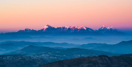
The Pindari Glacier is one of the most renowned glaciers in the Kumaon region of the Indian Himalayas. Located to the southeast of the majestic Nanda Devi and Nanda Kot peaks, it offers a remarkable trekking experience. Known for its stunning landscapes, the glacier is accessible via a moderately challenging trek that takes adventurers through quaint villages, dense forests, alpine meadows, and awe-inspiring views of the Himalayan range. Whether you’re a seasoned trekker or an adventure enthusiast looking to explore new frontiers, the Pindari Glacier Trek offers an unforgettable experience.
Geography and Significance
The Pindari Glacier is approximately 9 kilometers long and serves as the source of the Pindari River, which flows through the Kumaon region before merging with the Alakananda River at Karnaprayag. The glacier is surrounded by towering peaks such as Nandakot, Changuch, and Pwalidwar, all standing above 6,000 meters. These imposing mountain ranges add a surreal charm to the trek and provide trekkers with incredible photo opportunities.
The Pindari Glacier is one of the most accessible glaciers in the Kumaon Himalayas, making it a popular destination for those seeking to experience the majestic beauty of the high-altitude mountains without requiring advanced mountaineering skills.
Trekking to the Glacier: The Route
The trek to the Pindari Glacier takes adventurers through a diverse range of landscapes, starting from the town of Bageshwar and passing through Loharkhet, Khati, Dwali, and Phurkia before reaching the Zero Point of the glacier.
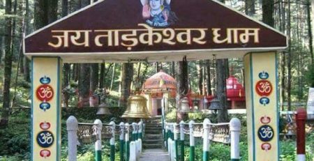
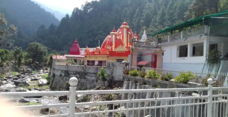
- Bageshwar and Loharkhet: The trek begins in the sacred town of Bageshwar, which is accessible by road. From here, trekkers make their way to Loharkhet, a scenic base for the trek.
- Saung and Dhakuri: The trail proceeds through Saung, a charming village, and ascends to the Dhakuri Pass. As trekkers move higher, the views of the surrounding peaks become more dramatic.
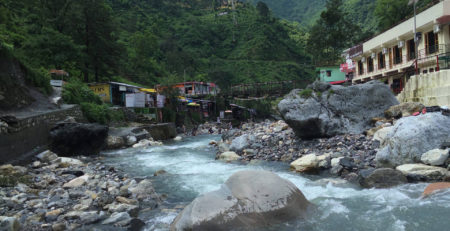
- Khati Village: The trek continues to Khati Village, which is the last inhabited village along the trail. Khati offers a glimpse into the local life and culture of the region’s inhabitants, who are mostly shepherds and farmers.
- Dwali and Phurkia: From Khati, the route ascends to Dwali, followed by a further climb to Phurkia, an alpine meadow. This is where the tree line starts to give way to alpine pastures, providing trekkers with stunning vistas of the surrounding mountains.
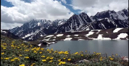
- Zero Point, Pindari Glacier: The final destination of the trek is the Zero Point of the Pindari Glacier, where trekkers are rewarded with breathtaking views of the glacier and the surrounding peaks. The glacier is about 3 kilometers long and 250 meters wide, offering a fascinating sight with its icy blue expanse.
Trek Details and Duration
The Pindari Glacier Trek spans about 90 kilometers (56 miles) round trip and typically takes 6 days to complete. The trail is moderately difficult, making it accessible to most trekkers with basic fitness levels. The trekking route offers diverse landscapes, from lush forests and meadows to rocky and rugged terrains, requiring good stamina and proper preparation.
The trek is relatively comfortable for those with prior trekking experience, although beginners may find the altitude and the long distances physically challenging. The total ascent is gradual, making it easier for trekkers to acclimatize.
Adventure Sports at Pindari Glacier
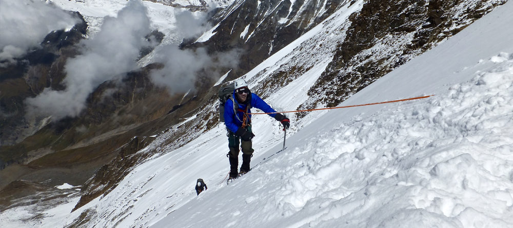
The Pindari Glacier is not only a trekker’s paradise but also offers opportunities for adventure sports like ice climbing and mountain biking. The surrounding alpine environment provides the perfect backdrop for these activities, and adventure enthusiasts can make the most of their visit by participating in these exciting pursuits.
Best Time to Trek
The best months to undertake the Pindari Glacier Trek are April to June and September to October. During these months, the weather is relatively pleasant, with clear skies and moderate temperatures, providing ideal trekking conditions. It is advisable to avoid the monsoon season (July to August) as heavy rains can make the trails slippery and more challenging.
Wildlife and Flora
The Pindari Glacier trek passes through the Bageshwar district’s forested areas, which are home to a variety of wildlife species. Trekkers may spot animals such as the Himalayan Tahr, Musk Deer, and Himalayan Monal, along with a wide range of bird species. The region is also rich in flora, with rhododendron and oak trees, as well as alpine meadows blanketed with wildflowers.
How to Reach
To begin the trek, one must reach Bageshwar, which is well-connected by road from major towns like Kathgodam and Almora. From Bageshwar, you can drive to Loharkhet or take a local jeep. The trek from Loharkhet to Khati and beyond is well-marked, and many trekking agencies offer guided tours for those who prefer assistance along the route.
Key Trek Facts
- Trek Duration: 6 days (round trip)
- Trail Difficulty: Moderate
- Maximum Elevation: 3,660 meters (Zero Point of Pindari Glacier)
- Total Distance: 90 kilometers (56 miles)
- Best Time to Visit: April to June, September to October
The Pindari Glacier Trek is a perfect blend of natural beauty, adventure, and cultural immersion. Whether you’re trekking to witness the awe-inspiring views of the glacier or indulging in ice climbing and other adventure sports, this trek offers something for everyone. It provides trekkers with an opportunity to explore the stunning landscapes of the Kumaon Himalayas and connect with the tranquil and untouched beauty of the Indian wilderness. For those looking to experience the raw beauty of the Himalayas, the Pindari Glacier trek is a must-visit destination.