Top 10 Rivers of Uttarakhand
The rivers of Uttarakhand originate from glaciers and high-altitude regions, shaping the state’s landscape and culture. From the sacred Ganga and Yamuna to the powerful Alaknanda and Bhagirathi, these rivers sustain agriculture, biodiversity, and hydroelectric power. Their religious, ecological, and economic significance makes them vital to Uttarakhand’s identity.
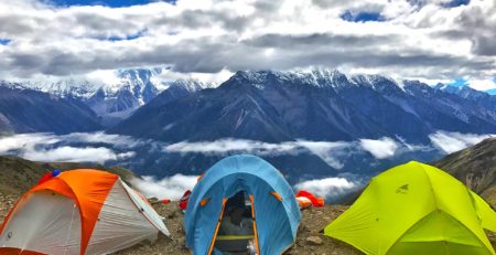
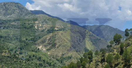
The rivers of Uttarakhand are the lifelines of this Himalayan state, shaping its geography, culture, and economy. Originating from glaciers and high-altitude lakes, these rivers provide fresh water, sustain agriculture, generate hydroelectric power, and hold immense religious significance. Uttarakhand is home to some of India’s most sacred rivers, including the Ganga and Yamuna, which are revered in Hinduism. Other major rivers such as the Bhagirathi, Alaknanda, and Kali contribute to the state’s rich biodiversity and irrigation systems. The rivers flow through deep valleys, gorges, and dense forests, supporting diverse ecosystems. However, these water bodies face challenges from climate change, deforestation, and pollution, making conservation efforts crucial. In this article, we explore the top 10 rivers of Uttarakhand, their origins, key tributaries, and significance. Understanding these rivers helps us appreciate their role in sustaining life and preserving the natural beauty of this Himalayan region.
🌊 Ganga River
📍 Origin: Gangotri Glacier
📏 Length: 2,525 km (Total)
🔹 Tributaries: Bhagirathi, Alaknanda, Mandakini
⭐ Key Fact: The holiest river in India, worshiped as Goddess Ganga.
The Ganga River is the most sacred and largest river in India, originating from the Gangotri Glacier in Uttarakhand. It plays a vital role in Indian culture, religion, and daily life, with millions considering it a source of spiritual purification. The river flows through Haridwar, Rishikesh, and Varanasi, supporting agriculture, hydroelectric projects, and biodiversity. Despite its purity at the source, pollution remains a major concern downstream. Major initiatives like Namami Gange aim to restore its cleanliness. The confluence of Bhagirathi and Alaknanda at Devprayag officially marks the formation of the Ganga.
🌊 Yamuna River
📍 Origin: Yamunotri Glacier
📏 Length: 1,376 km
🔹 Tributaries: Tons, Giri, Asan
⭐ Key Fact: Second-most sacred river after the Ganga.
The Yamuna River, originating from the Yamunotri Glacier in Uttarkashi, is the largest tributary of the Ganga. It holds immense religious significance, as it is believed to be the sister of Yama, the god of death, and taking a dip in it is said to remove sins. Flowing through Uttarakhand, Himachal Pradesh, Haryana, and Delhi, the river provides drinking water to millions. However, urbanization and industrial waste have heavily polluted its waters, especially near Delhi. The Tons River is its largest tributary, and the Yamuna is vital for irrigation and hydroelectric projects in northern India.
🌊 Bhagirathi River
📍 Origin: Gangotri Glacier
📏 Length: 205 km
🔹 Tributaries: Jadh Ganga, Bhilangna
⭐ Key Fact: Merges with Alaknanda at Devprayag to form the Ganga.
The Bhagirathi River is one of the two main headstreams of the Ganga. Originating from the Gangotri Glacier, it is named after King Bhagirath, who is believed to have brought the Ganga to Earth through intense penance. The river flows through Uttarkashi and Tehri, supporting hydroelectric projects like the Tehri Dam. It is considered extremely sacred, with pilgrims visiting Gangotri to seek blessings. Bhagirathi merges with Alaknanda at Devprayag, officially forming the Ganga River. Despite its divine status, hydropower development and deforestation threaten its natural flow and ecosystem.
🌊 Alaknanda River
📍 Origin: Satopanth Glacier
📏 Length: 195 km
🔹 Tributaries: Mandakini, Pindar, Nandakini, Dhauliganga
⭐ Key Fact: One of the two main tributaries of the Ganga.
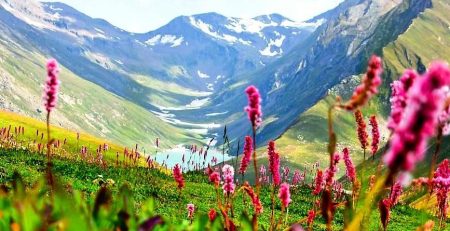
The Alaknanda River is a major Himalayan river, originating from the Satopanth Glacier near Badrinath. It is one of the primary tributaries of the Ganga, meeting Bhagirathi at Devprayag. The river is famous for Panch Prayag (five sacred confluences) where it meets Dhauliganga, Nandakini, Pindar, Mandakini, and Bhagirathi. It flows through Joshimath, Rudraprayag, and Srinagar, making it crucial for pilgrimage routes and hydroelectric projects. The river’s glacial meltwater sustains agriculture and biodiversity in the region, though climate change and deforestation threaten its flow.
🌊 Mandakini River
📍 Origin: Chorabari Glacier (near Kedarnath)
📏 Length: 81 km
🔹 Tributaries: Vasukiganga
⭐ Key Fact: Flows through Kedarnath, a major pilgrimage site.
The Mandakini River originates from the Chorabari Glacier near Kedarnath, one of the most sacred temples in India. It is a tributary of the Alaknanda River, merging at Rudraprayag. The river is closely associated with Hindu mythology and is considered holy. During the 2013 Uttarakhand floods, the Mandakini experienced massive devastation, causing destruction in Kedarnath and surrounding villages. The river is essential for pilgrims, agriculture, and hydroelectric projects. Its pristine waters and scenic surroundings make it an important part of Uttarakhand’s natural beauty and religious tourism.
🌊 Pindar River
📍 Origin: Pindari Glacier
📏 Length: 105 km
🔹 Tributaries: Kali Ganga
⭐ Key Fact: Joins Alaknanda at Karnaprayag.
The Pindar River originates from the Pindari Glacier in Kumaon Himalayas and is known for its turquoise waters and rugged terrain. It is a key tributary of the Alaknanda, merging at Karnaprayag. The river is famous among trekkers who follow the Pindari Glacier Trek. It supports local communities, agriculture, and hydropower. The Pindar’s fast-flowing waters create rapids, making it significant for river rafting and adventure sports. However, climate change is affecting the glacier’s size, impacting the river’s flow over time.
🌊 Dhauliganga River
📍 Origin: Niti Pass
📏 Length: 94 km
🔹 Tributaries: Rishiganga
⭐ Key Fact: Forms a major hydroelectric project.
The Dhauliganga River, originating from Niti Pass, is one of the six tributaries of the Alaknanda. It flows through Chamoli district and is vital for hydroelectric power, with the Dhauliganga Dam playing a crucial role in Uttarakhand’s energy production. The river gained attention due to the 2021 Chamoli disaster, when a glacial burst triggered flash floods, affecting villages and hydropower plants. The river’s pristine beauty and strategic importance make it significant for both nature lovers and engineers.
🌊 Kali (Sharda) River
📍 Origin: Kali Glacier, Pithoragarh
📏 Length: 252 km
🔹 Tributaries: Gori Ganga, Saryu
⭐ Key Fact: Forms the Indo-Nepal border.
The Kali River, also known as the Sharda River, originates from the Kali Glacier in Pithoragarh. It serves as a natural boundary between India and Nepal. The river is famous for hydropower projects, including the Tanakpur Hydroelectric Plant. It merges with the Gori Ganga and Saryu Rivers, supporting irrigation, biodiversity, and local communities. The river is also known for white-water rafting and is an essential water source for the Terai region.
🌊 Tons River
📍 Origin: Bandarpunch Glacier
📏 Length: 148 km
🔹 Tributaries: Pabbar River
⭐ Key Fact: Largest tributary of the Yamuna.
The Tons River, originating from the Bandarpunch Glacier, is the largest tributary of the Yamuna River. It flows through Garhwal and Himachal Pradesh, known for its rugged terrain and rapids. The river is famous for adventure sports, particularly white-water rafting. It plays a significant role in local irrigation and biodiversity. The Tons is also associated with Hindu mythology, believed to be stronger than the Yamuna at their confluence.
🌊 Ramganga River
📍 Origin: Namik Glacier (Kumaon region)
📏 Length: 596 km
🔹 Tributaries: Khoh, Palain
⭐ Key Fact: Flows through Jim Corbett National Park.
The Ramganga River is a major river of Uttarakhand, originating from the Namik Glacier in the Kumaon region. It is an important tributary of the Ganga, playing a crucial role in wildlife conservation as it flows through Jim Corbett National Park, providing a lifeline for diverse flora and fauna. The river is divided into the Eastern and Western Ramganga, with the Western Ramganga merging into the Ganga near Kannauj. The river supports irrigation, hydroelectric projects, and local communities, but deforestation and pollution pose threats to its ecosystem.
Other Major Rivers of Uttarakhand
🌊 Saryu River
📍 Origin: Sarmul, Pithoragarh
📏 Length: 146 km
🔹 Tributaries: Gomti, Panar
⭐ Key Fact: Joins Kali River at Pancheshwar.
The Saryu River originates from Sarmul in the Pithoragarh district and merges with the Kali River at Pancheshwar, a place of religious significance. The river is closely associated with Hindu traditions, and its name appears in ancient texts and folklore. It serves as a lifeline for agriculture in the Kumaon region, providing irrigation and fresh water. The Pancheshwar Dam project has been proposed on the Saryu-Kali confluence to boost hydroelectric production and flood control.
🌊 Gori Ganga
📍 Origin: Milam Glacier (Munsiyari)
📏 Length: 104 km
🔹 Tributaries: Ralam Gad, Lwan Gad
⭐ Key Fact: Flows through the Munsiyari valley.
The Gori Ganga River originates from the Milam Glacier, near Munsiyari in the Pithoragarh district. The river flows through deep gorges and is known for its turbulent waters. It merges with the Kali River near Jauljibi. The Johar Valley, home to the Bhotia tribal community, thrives along its banks. The river plays a significant role in hydroelectric projects, but glacial retreat and deforestation threaten its flow.
🌊 Kosi River
📍 Origin: Kausani (Almora)
📏 Length: 168 km
🔹 Tributaries: Gaula
⭐ Key Fact: Essential for agriculture in the Kumaon region.
The Kosi River originates near Kausani in Almora and is a vital water source for the Kumaon region. It is not to be confused with the Kosi River of Bihar. The river is seasonal, with high flow in monsoon and low flow in summer, affecting agriculture. The river provides drinking water and irrigation, but deforestation and soil erosion have increased the risk of flash floods. Conservation efforts are ongoing to preserve its natural flow.
🌊 Gaula River
📍 Origin: Bhimtal, Kumaon
📏 Length: 103 km
🔹 Tributaries: Kichha, Baur
⭐ Key Fact: A major source of groundwater recharge.
The Gaula River, originating from Bhimtal in Nainital district, plays a significant role in groundwater recharge and supports agriculture and urban areas. The river flows through Haldwani, where excessive sand mining has led to environmental degradation. Efforts are being made to regulate illegal mining and conserve the river.
🌊 Supaligad River
📍 Flows in: Pithoragarh
📏 Length: Short but vital
⭐ Key Fact: Supports local communities in Pithoragarh.
The Supaligad River is a lesser-known yet important river flowing in the Pithoragarh district. It plays a crucial role in agriculture and local water supply, ensuring sustainable development for nearby villages.
🌊 Bhilling Canal
📍 Origin: Chamoli
📏 Length: N/A
⭐ Key Fact: Supports irrigation in Chamoli.
The Bhilling Canal is an artificial canal in Chamoli district, constructed to support local irrigation and agriculture. It helps distribute glacial meltwater efficiently to farmlands and villages.
🌊 Bhugmad River
📍 Origin: Almora region
📏 Length: Short but vital
⭐ Key Fact: Provides fresh water to Almora’s rural areas.
The Bhugmad River is a seasonal river flowing through the Almora region, supplying freshwater to villages and agricultural lands.
🌊 Rispana River
📍 Origin: Mussoorie (Dehradun)
📏 Length: 30 km
⭐ Key Fact: Faces heavy pollution due to urbanization.
The Rispana River, originating from Mussoorie, flows through Dehradun before merging into the Suswa River. Due to rapid urbanization, it has become heavily polluted, with efforts underway to revive and clean the river.
🌊 Bindal River
📍 Origin: Dehradun
📏 Length: Short but important
⭐ Key Fact: Flows through Dehradun, contributing to the Suswa River.
The Bindal River is another small river in Dehradun, which merges with the Suswa River. It is highly polluted due to sewage and industrial waste.
🌊 Song River
📍 Origin: Mussoorie region
📏 Length: 70 km
⭐ Key Fact: Merges with the Suswa River.
The Song River originates in the Mussoorie region and is an important tributary of the Ganga, merging with the Suswa River. It is essential for irrigation, groundwater recharge, and biodiversity in the Doon Valley.
🌊 Suswa River
📍 Origin: Dehradun
📏 Length: 50 km
⭐ Key Fact: Joins the Ganga near Rishikesh.
The Suswa River, originating in Dehradun, merges with the Ganga near Rishikesh. It plays a vital role in local water management, though encroachments and pollution threaten its existence.
FAQs – Top 10 Rivers of Uttarakhand
❓ Which are the top 10 rivers of Uttarakhand?
✅ Uttarakhand is home to many important rivers, but the top 10 rivers are:
- Ganga River – Originates from the Gangotri Glacier, the holiest river of India.
- Yamuna River – Originates from the Yamunotri Glacier, a major tributary of the Ganga.
- Bhagirathi River – One of the two main headstreams of the Ganga, originating from the Gangotri Glacier.
- Alaknanda River – Originates from the Satopanth Glacier and merges with the Bhagirathi at Devprayag.
- Mandakini River – Flows near Kedarnath and merges with the Alaknanda at Rudraprayag.
- Pindar River – Originates from the Pindari Glacier and merges with the Alaknanda.
- Dhauliganga River – Originates from the Niti Pass and is an important tributary of the Alaknanda.
- Tons River – Originates from the Bandarpunch Glacier and is the largest tributary of the Yamuna.
- Ramganga River – Originates from the Namik Glacier and flows through Jim Corbett National Park.
- Saryu River – Originates from Sarmul in Pithoragarh and merges with the Kali River.
❓ Which is the longest river in Uttarakhand?
✅ The Ganga River is the longest river in Uttarakhand and India. Although its total length is 2,525 km, it flows for about 450 km in Uttarakhand before entering Uttar Pradesh. The river is formed by the confluence of Bhagirathi and Alaknanda Rivers at Devprayag.
❓ Which is the deepest river in Uttarakhand?
✅ The Tons River is considered the deepest river in Uttarakhand. It is also one of the fastest-flowing rivers, originating from the Bandarpunch Glacier and eventually merging with the Yamuna River.
❓ Which river is the coldest in Uttarakhand?
✅ The Bhagirathi and Pindar Rivers are among the coldest rivers in Uttarakhand, as they originate from glacial sources in the Himalayas. Their waters remain icy cold throughout the year, especially near their points of origin.
❓ Which river is known as the ‘Sorrow of Uttarakhand’?
✅ The Kosi River is sometimes called the ‘Sorrow of Uttarakhand’ because of its frequent flooding, particularly in the Kumaon region. The river flows through Almora and Nainital districts and causes soil erosion and destruction during the monsoon season.
❓ Which river flows through Jim Corbett National Park?
✅ The Ramganga River flows through Jim Corbett National Park. It is a lifeline for the park’s rich wildlife, providing water to animals like tigers, elephants, crocodiles, and birds. The Ramganga eventually joins the Ganga River.
❓ Which is the most sacred river in Uttarakhand?
✅ The Ganga River is considered the holiest river in Uttarakhand and all of India. It is worshipped as Goddess Ganga in Hinduism. Pilgrims visit cities like Haridwar and Rishikesh to take a holy dip in its waters.
❓ Which rivers originate from glaciers in Uttarakhand?
✅ Many rivers in Uttarakhand originate from glaciers. Some of the important ones are:
- Ganga River – Origin: Gangotri Glacier
- Yamuna River – Origin: Yamunotri Glacier
- Bhagirathi River – Origin: Gangotri Glacier
- Alaknanda River – Origin: Satopanth Glacier
- Mandakini River – Origin: Chorabari Glacier
- Pindar River – Origin: Pindari Glacier
- Tons River – Origin: Bandarpunch Glacier
- Kali River – Origin: Kali Glacier
❓ Which rivers are known for white-water rafting in Uttarakhand?
✅ The Ganga River in Rishikesh is the most famous river for white-water rafting, attracting thousands of adventure seekers every year. The Tons River is also known for high-intensity rafting, with Class IV and V rapids, making it one of the most challenging rafting destinations in India.
❓ Which river is used for hydroelectric power generation in Uttarakhand?
✅ Many rivers in Uttarakhand are used for hydroelectric projects, including:
- Bhagirathi River – Tehri Dam, one of India’s largest hydroelectric projects.
- Alaknanda River – Vishnuprayag and Srinagar Hydropower Projects.
- Dhauliganga River – Dhauliganga Hydroelectric Project.
- Tons River – Used for smaller hydropower projects.
❓ Which river forms the natural boundary between Uttarakhand and Nepal?
✅ The Kali River (Sharda River) forms the natural border between Uttarakhand and Nepal. It originates from the Kali Glacier in Pithoragarh district and flows along the India-Nepal border before merging with the Ghaghra River.
❓ Which river is the main tributary of the Yamuna in Uttarakhand?
✅ The Tons River is the largest tributary of the Yamuna River in Uttarakhand. It originates from the Bandarpunch Glacier and is known for its deep gorges and high-speed currents.
❓ Which river is famous for trout fishing in Uttarakhand?
✅ The Tons and Ramganga Rivers are famous for trout fishing in Uttarakhand. The cold and clean waters of these rivers provide a perfect habitat for Mahseer and Brown Trout.
❓ How does climate change affect the rivers of Uttarakhand?
✅ Climate change is impacting Uttarakhand’s rivers through:
- Glacier retreat – Melting glaciers are altering river flow patterns.
- Floods and droughts – Irregular rainfall is causing extreme weather conditions.
- Water pollution – Increasing tourism and urbanization are affecting water quality.
❓ Which river is most important for religious tourism in Uttarakhand?
✅ The Ganga River is the most important river for religious tourism in Uttarakhand. The towns of Haridwar, Rishikesh, Devprayag, and Gangotri attract millions of Hindu pilgrims every year.
❓ What are the five important confluences (Panch Prayag) of Uttarakhand?
✅ Uttarakhand is home to Panch Prayag, the five sacred confluences where important rivers meet:
- Vishnuprayag – Alaknanda meets Dhauliganga
- Nandaprayag – Alaknanda meets Nandakini
- Karnaprayag – Alaknanda meets Pindar
- Rudraprayag – Alaknanda meets Mandakini
- Devprayag – Alaknanda meets Bhagirathi to form the Ganga
❓ Which river has the most number of tributaries in Uttarakhand?
✅ The Ganga River has the most tributaries in Uttarakhand. Major tributaries include Bhagirathi, Alaknanda, Mandakini, Dhauliganga, Pindar, Nandakini, Yamuna, Tons, Ramganga, and Saryu Rivers.
❓ Which river in Uttarakhand is prone to flash floods?
✅ The Alaknanda, Mandakini, and Kosi Rivers are prone to flash floods, especially during the monsoon season. The Kedarnath floods of 2013 were caused by excessive rainfall and glacial melting in the Mandakini River.
❓ Which river is famous for hot water springs along its course?
✅ The Alaknanda River has natural hot water springs near Badrinath, called Tapt Kund, which are believed to have medicinal properties.
❓ Which river is known for the Valley of Flowers National Park?
✅ The Pushpawati River, a tributary of the Alaknanda River, flows through the Valley of Flowers National Park, a UNESCO World Heritage Site known for its diverse flora and rare species.
❓ Which river in Uttarakhand flows in both Garhwal and Kumaon regions?
✅ The Ramganga River is unique as it originates in Kumaon (Namik Glacier) but later flows through Garhwal before merging with the Ganga River.
❓ Which river in Uttarakhand has the highest hydropower potential?
✅ The Bhagirathi River has the highest hydropower potential due to projects like the Tehri Dam, which generates 1,000 MW of electricity. Other rivers with significant hydropower projects include Alaknanda, Dhauliganga, and Mandakini Rivers.
❓ Which river is considered the cleanest in Uttarakhand?
✅ The Bhagirathi River is considered one of the cleanest rivers in Uttarakhand due to its glacial origin and government efforts to reduce pollution before it merges with the Alaknanda at Devprayag.
❓ Which river in Uttarakhand has the highest altitude origin?
✅ The Bhagirathi River, originating from the Gangotri Glacier at an altitude of around 4,100 meters (13,500 feet), is one of the highest-origin rivers in Uttarakhand.
❓ Which river flows through Dehradun city?
✅ The Rispana and Bindal Rivers flow through Dehradun, but they have been severely polluted due to urbanization. The Song River, a tributary of the Ganga, also flows near Dehradun.
❓ Which river is responsible for the water supply in Nainital?
✅ The Kosi River, originating from Kausani (Almora), is the main water source for Nainital and surrounding areas.
❓ Which river in Uttarakhand is most important for irrigation?
✅ The Ramganga and Kali Rivers are the most important rivers for irrigation in Uttarakhand. These rivers support agriculture in the Terai region, which is known for rice, wheat, and sugarcane farming.
❓ Which river is named after a Hindu deity?
✅ The Mandakini River is named after Goddess Mandakini, a sacred river goddess in Hindu mythology. It flows near the Kedarnath temple and merges with the Alaknanda at Rudraprayag.
❓ Which river forms a beautiful confluence with the Ganga in Rishikesh?
✅ The Chandrabhaga River, a small yet scenic river, merges with the Ganga River in Rishikesh, creating a picturesque confluence.
❓ Which river originates from the famous Milam Glacier?
✅ The Gori Ganga River originates from the Milam Glacier in the Munsiyari region and is an important tributary of the Kali River.
❓ Which river in Uttarakhand has a unique emerald-green color?
✅ The Saryu River, especially in its upper reaches, has a striking emerald-green color due to the presence of minerals from the surrounding mountains.
❓ Which river is called the ‘Lifeline of the Terai region’?
✅ The Kali River (Sharda River) is called the Lifeline of the Terai region as it provides water for agriculture and hydroelectric projects in both Uttarakhand and Uttar Pradesh.
❓ Which river in Uttarakhand is known for its medicinal properties?
✅ The Tamsa River, which originates near Tehri Garhwal, is believed to have medicinal properties due to the presence of herbal plants in its surroundings.
❓ Which river in Uttarakhand has the highest number of waterfalls?
✅ The Song River, originating from the Mussoorie hills, has several waterfalls, including Kempty Falls and Jharipani Falls.
❓ Which river played a crucial role in ancient trade routes?
✅ The Kali River (Sharda River) was historically significant for trade between India and Tibet. Ancient traders and pilgrims used its banks for their journeys.
❓ Which rivers form the famous ‘Prayags’ (confluences) in Uttarakhand?
✅ The Panch Prayag (Five Sacred Confluences) in Uttarakhand are formed by these rivers:
- Vishnuprayag – Alaknanda meets Dhauliganga
- Nandaprayag – Alaknanda meets Nandakini
- Karnaprayag – Alaknanda meets Pindar
- Rudraprayag – Alaknanda meets Mandakini
- Devprayag – Alaknanda meets Bhagirathi (forming the Ganga)
❓ Which river is most important for the Char Dham Yatra?
✅ The Alaknanda River is the most important river for the Char Dham Yatra as it flows near Badrinath, Kedarnath (via Mandakini), and Devprayag, where it merges with the Bhagirathi to form the Ganga.
The rivers of Uttarakhand are not only the lifelines of the state but also hold immense religious, ecological, and economic significance. They provide freshwater, support biodiversity, and sustain agriculture and hydroelectric power. Many rivers, such as the Ganga, Yamuna, and Bhagirathi, have deep spiritual importance in Hinduism. However, climate change, pollution, deforestation, and unplanned urbanization are threatening their natural flow and purity. Conservation efforts, including government projects and local initiatives, are essential to preserve these rivers for future generations. Protecting these rivers is not just a regional responsibility, but a national and global necessity.